James Von Tersch, August 2, 2023
When we think of water in California’s Central Valley, we usually think of two major watersheds, the Sacramento River Basin and the San Joaquin River Basin. In actuality, there are three major watersheds, the third being the Tulare Lake Basin. While the Sacramento and San Joaquin Rivers outflow into the San Francisco Bay, rivers departing the Sierra Nevada Mountains south of the San Joaquin River historically flowed into Tulare, Kern, Buena Vista, Goose, and Summit Lakes. Tulare Lake was the largest of the five, being 790 square miles at its fullest extent, and was once boasted as the largest freshwater lake west of the Mississippi River. Only in high water years would the Tulare Lake overflow, turn the Kings River backwards, and outflow into the San Joaquin River, eventually reaching the San Francisco Bay.
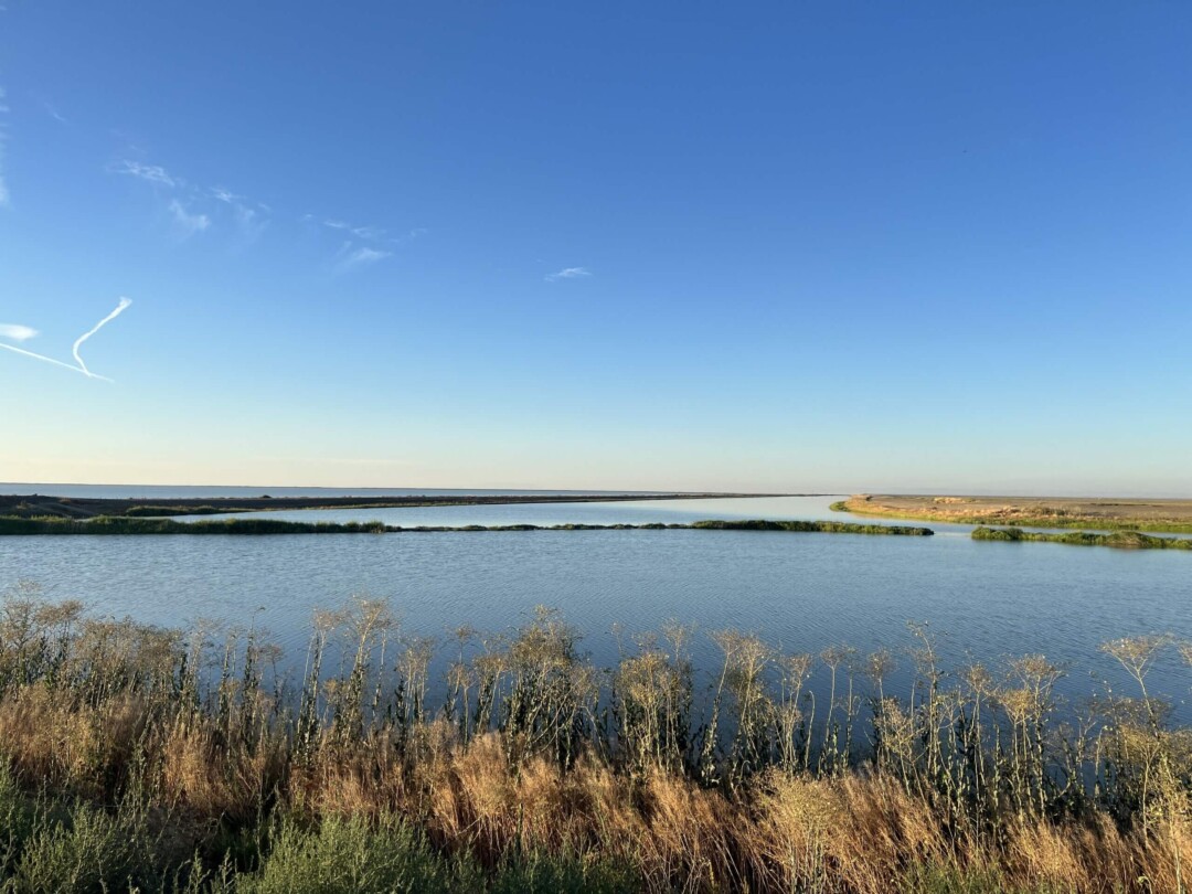
From North to South, the major rivers flowing into Tulare Lake are the Kings, Kaweah, Tule, and Kern. All of these generally flow west, roughly parallel to each other, from the Sierra Nevada in the east. The Kern historically flowed first into Kern and Buena Vista Lakes, which then overflowed north into Tulare Lake via the Buena Vista Slough. Together, these lakes were part of an expansive system of marshlands on the west side of the valley that extended from Buena Vista and Kern Lakes in the south to the Sacramento-San Joaquin Delta in the north. During high water years, it was possible to take a boat from San Francisco Bay to Bakersfield if you could find your way through the maze of tule marshes. Tule (Toolē) is the name of the large bulrush that once dominated the marshlands of the valley, including those that surrounded Tulare Lake for about 100 yards from the shoreline, except in the south, where it extended for 15 miles. Tulare is the Spanish name for Tules or Tule marshes. Willows and buttonbush also grew thick where the rivers and streams met the lake.
Before the colonialization of California, several Yokuts tribes lived along the shores of Tulare Lake. The north, west, and southwest shores of the lake are the traditional homelands of the Tachi tribe. Today, the Tachi Tribe is centered at the Santa Rosa Rancheria, 4.5 miles southeast of Lemoore, ancestral land they had to purchase back for themselves. On the southeastern shore of the lake, including the series of islands off the lake’s southern shoreline, is the traditional land of the Wowol. On the northeastern shore and along the lower branches of the Kaweah Delta is the traditional land of the Chunut tribe. For several other Native Californians living in Central California, Tulare Lake was an important place where trips would be made in the summer to hunt and fish.
Historically, the lake harbored an abundance of wildlife in and around it. This included Grizzly and black bears, Tule Elk, Pronghorn Antelope, several types of deer, gray wolves, coyotes, mountain lions, bobcats, foxes, beavers, otters, as well as various snakes and frogs. Tulare Lake was also a major stop for hundreds of thousands of waterfowl migrating along the Pacific Flyway. This included ducks, sandhill cranes, geese, swans, curlews, snipe, and galls. Fish populations included what was known as “lake trout,” Sacramento Perch, and, during periods of overflow, salmon and sturgeon. The lake was also known for its large populations of Western Pond Turtles.
Tulare Lake has always been relatively shallow, only 39 feet at the deepest recorded level. For several miles from the shoreline, the lake was only 4-5 feet deep. This led to a shoreline that would rapidly change depending on the season, water year, and even the wind. Historically, the lake would fluctuate between 400 and 790 square miles depending on the water year. For the Yokuts tribes living along the lakeshore, this meant having to move villages wherever the lake shifted to. Boats were always necessary and were constructed from the tules that grew in the marshes around the lake. Tules were also used for the construction of houses, beds, granaries, baskets, clothing, duck decoys, and many other necessities.
Following the American takeover of California and the influx of miners heading across the valley towards the Sierra Nevada Mountains, Tulare Lake was depopulated. The lake tribes were forced onto reservations far from their home or killed. Some were able to survive hiding amongst the tules but were not able to stay for long. Tulare Lake would then become a popular place to make hunting and fishing expeditions for Americans around the state, similar to what it had been for Native Californians. The communities of Hanford and Lemoore held large fishing industries, where fish and terrapin would be shipped to San Francisco by the ton. Elk and Antelope were soon nearly hunted to extinction and extirpated from the lake. Gold miners soon turned towards ranching and moved hogs onto the lake shore to fatten up on the tule fibers. Many of these hogs would escape and become wild.
In the 1870s, the San Joaquin Valley began to change from dry farming and ranching to irrigation agriculture. Beginning on the Kings and Kaweah Rivers, farmers came together and began to form Irrigation Districts. These Irrigation Districts began constructing canals and ditches that brought water out the rivers of the valley and onto the dry plains to be used to grow crops. By 1900, the Kings River, which is the source of the majority of the water that flows into the lake, was behind only the Nile and Indus Rivers in the amount of land it irrigated. As water began to be diverted from the rivers to the plains, Tulare Lake gradually began to decrease in size. With the help of the Swampland Act of 1850, farmers began to plant crops on the receding shoreline of the lake. Following increasing diversions and a series of droughts, the alkalinity of Tulare, Buena Vista, and Kern Lakes reached a point where their ecosystems collapsed by 1888. The following year, the lakes went completely dry for the first time on record. Park rangers in Sequoia, Kings Canyon, and Yosemite National Parks all recorded a major decline in waterfowl populations in the parks coinciding with the loss of Tulare Lake.
After the collapse, the lake would rapidly return with major flooding and then rapidly dry out within the following year or two. The lake returned in 1901, went dry, then returned to about half its maximum size in 1906. The flooding that brought the lake’s return caused huge financial losses for the lake farmers, who had attempted to build levees to keep the water out. In 1907, the lake farmers built a massive square-shaped levee on all four sides of the lake, keeping it constrained to a much smaller area. Flooding in 1916 caused the lake to return, but the lake was essentially dry from then until its major resurgence from 1937-1946. Portions of the lake again returned for a short time in 1950, 1952, and 1955.
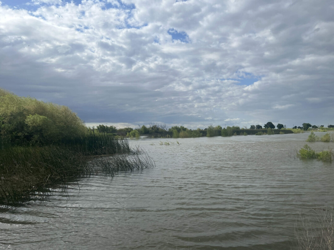
The continual filling of the lake bed and the financial losses of the lake farmers led to calls for large dams to be constructed on the rivers that fed Tulare Lake. Following an intense feud in Congress between the Bureau of Reclamation and the Army Corp of Engineers, the Army Corp was authorized to build dams on the Kings, Kaweah, Tule, and Kern rivers between 1953-1962 with the purpose of providing flood protection for the lake farmers. Still, the lake returned, most notably in 1969, 1983, and 1997, as well as this year.
Due to the nature of flooding in the Tulare Lake bed, the farmers that were able to survive the financial ruin it brought formed large landholdings on the lake bed. The largest of these landowners is the J.G. Boswell Co., a major producer of pima cotton, tomatoes for paste, seed crops, and livestock operations.
Today, there are several ways water is kept out of the lake bed. This includes pumping the water into the San Joaquin River, into the California Aqueduct and thus the Los Angeles area, into the Friant-Kern canal and eventually Los Angeles, and trying to spread the water amongst downstream users of the four dams to minimize the amount of water reaching the lake. This includes groundwater recharge basins, which have been rapidly built along the rivers this year to help absorb as much water as possible into the groundwater and keep water out of the lake. The number one way water leaves Tulare Lake, however, is evaporation. At the bottom of Tulare Lake is the Corcoran Clay, which prevents water from seeping into the groundwater, keeping it at the surface.
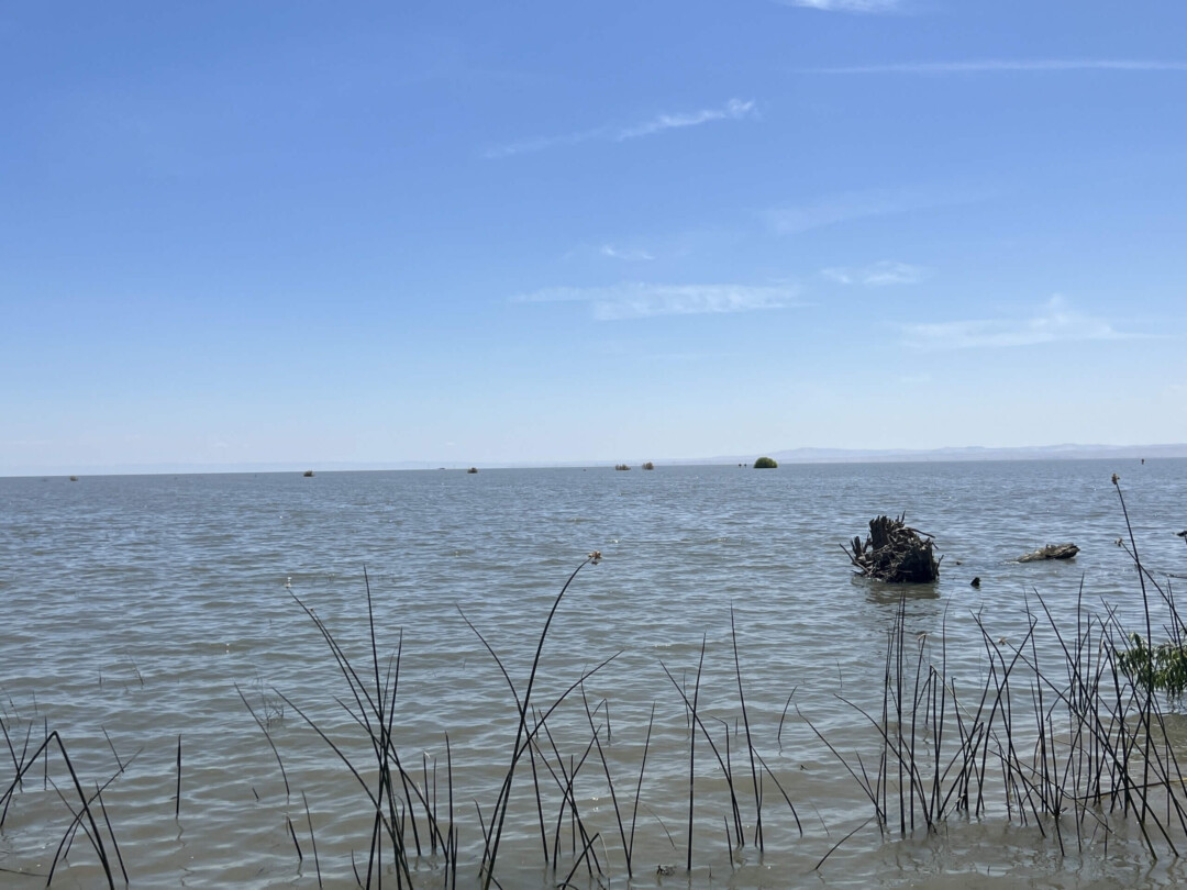
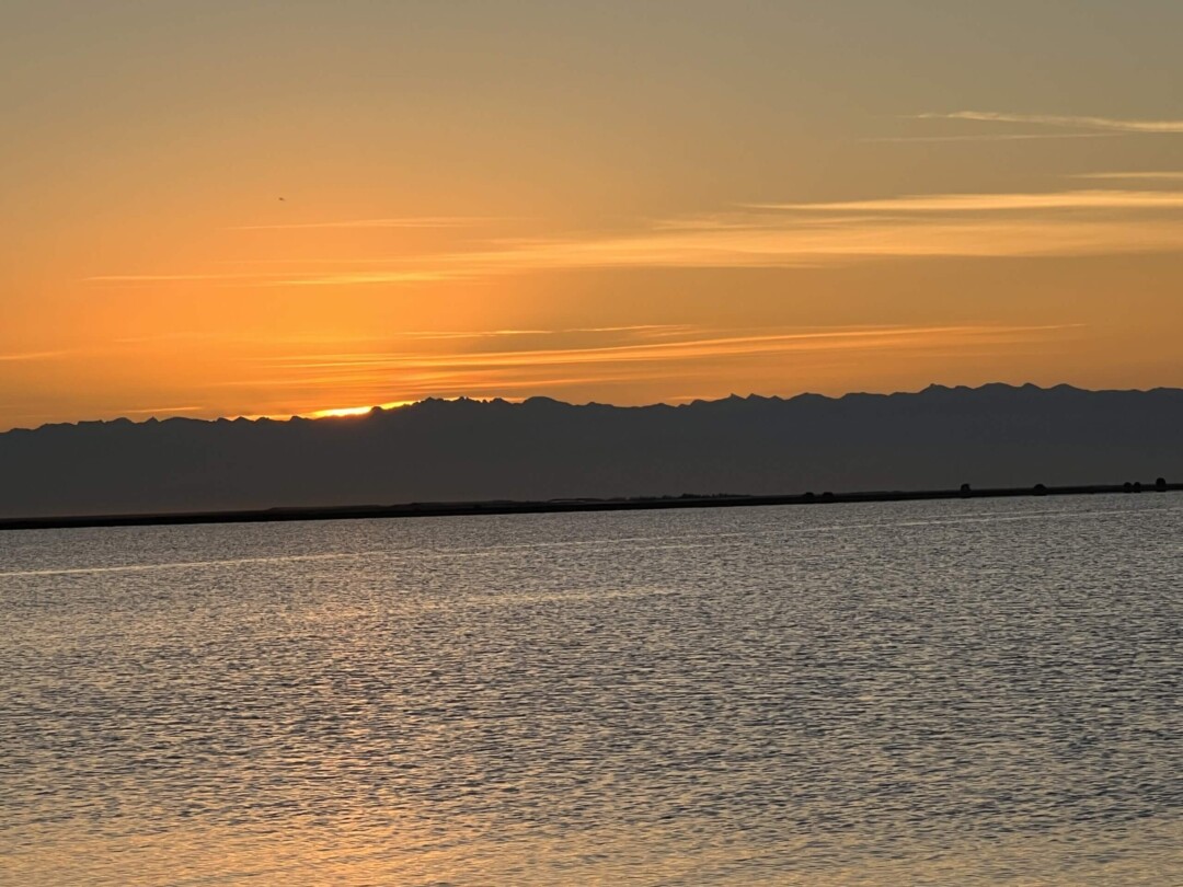
This year, 2023, the lake filled after historic precipitation in March and April. At its peak in the beginning of June, the lake was 178 square miles and about 5-7 feet at its deepest. Most of the water contributing to the lake came from Kings River, but the Kaweah, Tule, and Kern all experienced major flooding as well. Parts of Sequoia Riverlands Trust’s Kaweah Oaks Preserve flooded for the first time since the Terminus Dam was built in 1962.
Sources:
Floods and Droughts in the Tulare Lake Basin – John T. Austin
Streams of the San Joaquin – Robert Edminster
Handbook of Yokuts Indians – Frank Latta
