Contact: Jason Ince, Information Officer, Public Affairs, Department of Water Resources
(916) 820-8138 | Media@water.ca.gov
Published:
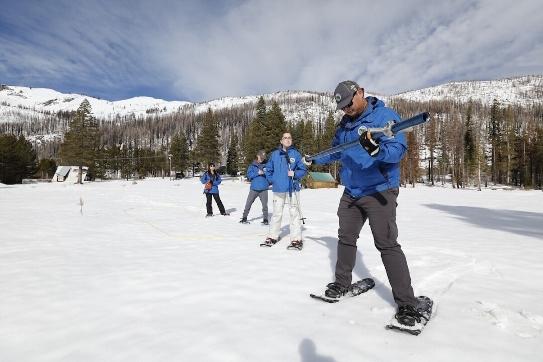
SACRAMENTO, Calif. – The Department of Water Resources (DWR) today conducted the second snow survey of the season at Phillips Station. The manual survey recorded 29 inches of snow depth and a snow water equivalent of 10 inches, which is 58 percent of average for this location. The snow water equivalent measures the amount of water contained in the snowpack and is a key component of DWR’s water supply forecast.
Today’s results reflect a modest increase in the snowpack since January 1, but overall conditions are still far below normal. DWR’s electronic readings from 130 stations placed throughout the state indicate that the statewide snowpack’s snow water equivalent is 8.4 inches, or 52 percent of average for this date, an improvement from just 28 percent of average on January 1. One year ago, the snowpack statewide was 214 percent of average on February 1.
“This year’s El Niño has delivered below average precipitation and an even smaller snowpack,” said DWR Director Karla Nemeth. “Californians must prepare for all possible conditions during the remaining months of the rainy season.”
Despite additional precipitation in January, many storms so far this year have been warmer than average, producing rain rather than snow at higher elevations. Overall statewide precipitation is 82 percent of average for this date. Last year’s snowpack was aided by both above average precipitation and below average temperatures, which created a historic snowpack and improved reservoir storage statewide, which is still above average. Lake Oroville, the State Water Project’s largest reservoir, is currently 76 percent of average.
“Despite strong El Niño conditions in the Pacific Ocean, a high-pressure system and several other climate factors have led to below average conditions so far and most storm impacts have been focused along the coastal regions,” said Dr. Michael Anderson, State Climatologist with DWR. “Many of these storms have also been warmer than average and produced more rain and less snow, a far cry from last year’s near-record snowpack and once again demonstrating how California can swing from one extreme to another.”
Even though this winter has provided below average precipitation overall, it can only take one storm to produce severe flooding in the right circumstances. Communities in San Diego, the Bay Area and along the North Coast have already experienced flooding impacts this winter, highlighting the need to always be prepared for flood risk. DWR and the Joint State-Federal Flood Operations Center have been working with communities and emergency response agencies to coordinate flood response and provide training to prepare for flooding. All Californians should follow three basic steps to plan for possible floods:
- Be aware of your risk – know whether your home is downslope of a burn area or in a floodplain; pay attention to weather forecasts; listen to local authorities.
- Be prepared – always have an emergency evacuation kit ready; be ready to evacuate early; have a plan for where you will go in an emergency.
- Take action – subscribe to your local emergency providers to get updated information. If local authorities issue an evacuation order, do not delay, follow local guidelines for evacuation and never attempt to drive through a flooded roadway.
On average, the Sierra snowpack supplies about 30 percent of California’s water needs. Its natural ability to store water is why the Sierra snowpack is often referred to as California’s “frozen reservoir.” Data from these snow surveys and forecasts produced by DWR’s Snow Surveys and Water Supply Forecasting Unit are important factors in determining how DWR manages the state’s water resources.
DWR conducts five media-oriented snow surveys at Phillips Station each winter near the first of each month, January through April and, if necessary, May. The next survey is tentatively scheduled for March 1.
For California’s current hydrological conditions, visit California Water Watch
For more information on finding your flood risk, visit CAL OES
For information on obtaining flood insurance, visit the FEMA website
For information on how you can prepare your household for flood emergencies, visit Ready.gov
Additional Resources
- Video of today’s Phillips survey
- Digital photos of today’s Phillips survey
- B-roll of today’s Phillips survey
- Snowpack readings (View readings for current regional snowpack and historical snowpack comparison)
- Precipitation data (View current California Data Exchange Center charts for the Northern Sierra 8-station index for updated rainfall readings in the critical northern portion of the state, as well as the San Joaquin 5-station index and Tulare Basin 6-station index)
- Read the original article here
